How to Use Google Street View – Explained in Easy Steps
 Reviewed by Huzaifa Haroon
Google Maps is an invaluable tool for navigation, offering detailed maps and precise directions to a wide range of destinations. Its features transform both local and global travel, making it effortless to find your way—whether you are exploring familiar neighborhoods or entirely new cities. Beyond basic navigation, Google Maps also provides helpful functionalities like area and distance calculators, as well as immersive Street View experiences that add significant value for all users.
With Google’s Street View feature, you can virtually explore cities and neighborhoods as if you were physically present. Street View is intuitively designed, making it especially useful when you need directions to an unfamiliar place, want to preview a destination before your visit, or wish to investigate areas of interest in more detail.
How to Use Google Street View on a Web Browser
Street View is one of the most engaging features of Google Maps on desktop, allowing users to experience locations up close. For selected areas, Google Maps provides a direct stream to Street View. To access this feature, follow these steps:
- Enter a specific address or browse the map to locate your area of interest.
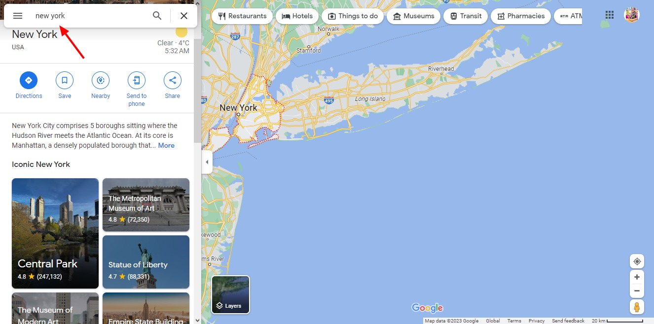
Search for an address you want to view in Street View - Click on “More” in the Layers menu, located in the bottom left of the map. Next, select “Street View.” The blue lines that appear indicate all available areas where you can activate Pegman (the Street View icon) for a panoramic view.
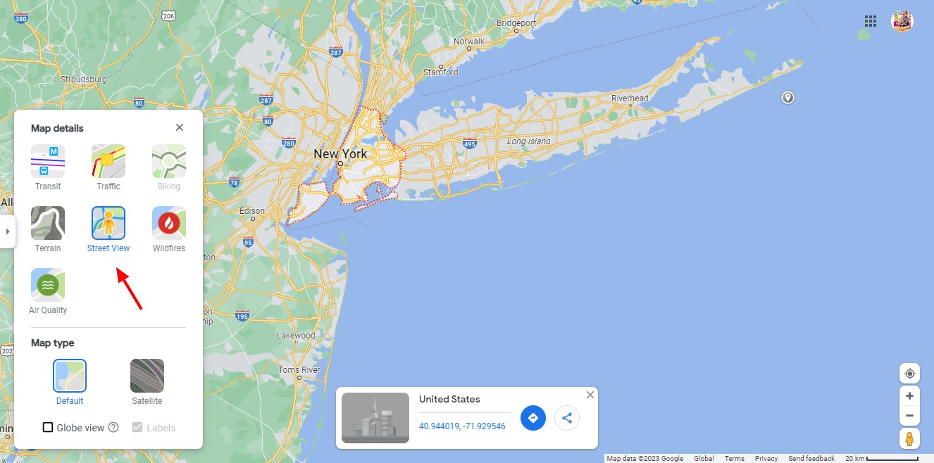
Select Street View from Layers menu - Access Pegman by clicking the icon in the upper right corner of Google Maps. Drag Pegman onto any blue-highlighted line on the map to view Street View. When positioning Pegman, the green highlight below will guide you to your exact destination.
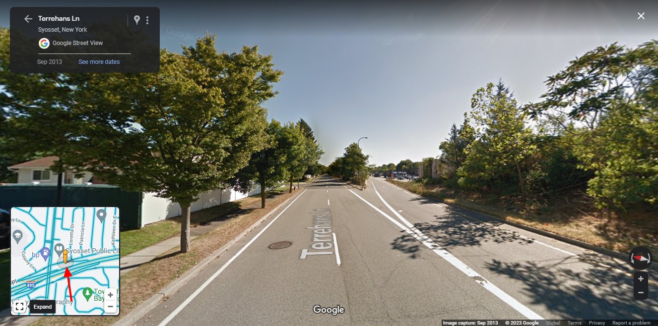
How to use Street View from Google Maps on the Web - Your screen will instantly switch to a street-level panoramic view, immersing you in the chosen location. Use the on-screen arrows or your mouse to navigate left or right, and select squares or arrows to move through the streets.
- If historical Street View images are available for the selected location, a clock icon will appear next to “Street View” in the location information box. Click the clock to access the timeline, and use the slider to view archived images from previous years.
- Selecting any older image from above the slider will set it as your main view. The chosen image, along with its date, will appear in Street View, providing a unique look at how the area has changed over time. To return to the current view, move the slider all the way to the right.
- You can exit Street View at any time by clicking the X in the upper right corner of the screen.
- Enter a specific address or browse the map to locate your area of interest.
Use Street View on iOS
Contrary to some common misconceptions, Google’s official support indicates that iOS users—including those on iPhones and iPads—have full access to Street View. To explore an area on iOS, follow these steps:
- Open the Google Maps app on your iOS device.
- Navigate to your desired location or press and hold on the map to drop a marker. You may also tap a feature of interest directly on the map.
- The address or name of the selected location will appear at the bottom of the screen.
- Tap the preview image to enter Street View for that location.
Use Street View on Android
- Launch the Google Maps app on your Android device.
- Type in an address to search for a location, or tap an existing marker on the map.
- Select the location’s name or address, which appears at the bottom of your screen.
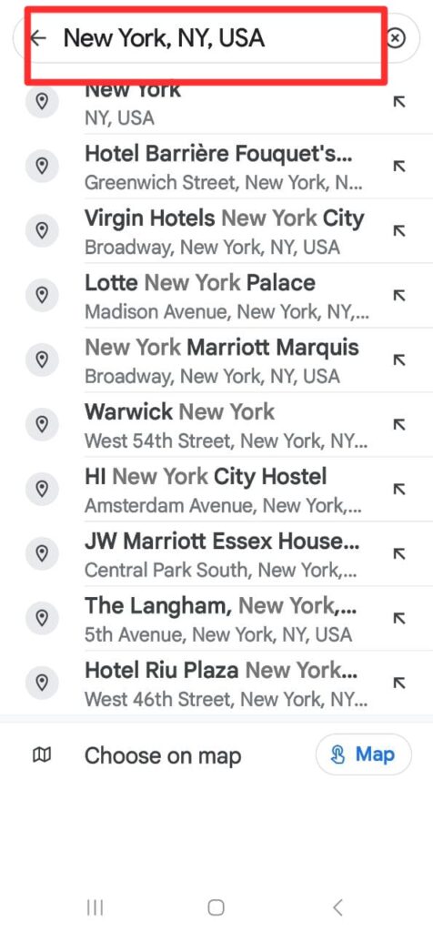
Select the location’s name in Street View Search Bar - Tap the “Street View” button or select the thumbnail with the Street View icon to begin exploring the area in panoramic detail.
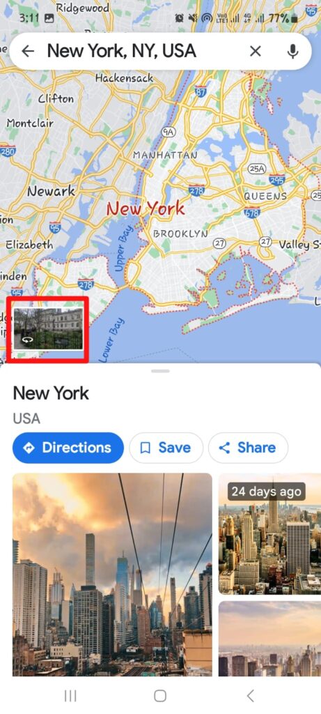
- You are now free to explore the area using Street View—simply use your finger to navigate and discover the surroundings.
If you wish to return to the map, tap the arrow or the map icon as needed.
What can you do in Street View?
When using Street View, you can enhance your virtual exploration with several interactive features:
To adjust your camera view, click and hold the left mouse button and move it left or right.
Explore the streets by clicking the directional arrows on the roads to move forward or backward.
Activate full-screen mode for a more immersive experience by selecting the full-screen button in the upper-right corner of the display.
Exit full-screen mode by pressing the ESC key or clicking the minimize icon on the right
To view your location in the main Google Maps interface, click the “View in Google Maps” link in the upper left. If you access Street View from services like Transpoco Locate, it will open in a new tab without disrupting your current session.
To leave Street View and return to the standard map view, click the left arrow in the top-left corner of your screen.
What Can You Not Do in Street View?
While Google encourages users to explore and utilize Street View, certain activities are not permitted in order to protect privacy and copyright.
- Digitizing or tracing information visible in Street View images to create new datasets.
- Using automated software or scripts to extract data from Street View imagery.
- Downloading Street View images for use outside Google’s environments (such as creating offline copies).
- Combining, merging, or stitching multiple Street View photos to produce large, composite images.
These restrictions apply equally to both commercial and non-profit projects. Adhering to these rules preserves the integrity of Google’s services and the copyrights of its contributors.
Required Attribution
Whenever you use Google Maps, Google Earth, or Street View content, proper attribution to Google and its data providers is required.
Copyright and attribution notices, such as “Map data 2019 Google,” are typically displayed at the bottom of the map or image. Please be aware that the specific wording may differ depending on your region or the type of content.
Reviewed by Huzaifa Haroon


